Understanding marine ecosystems, commercial fishing and marine operation
Map and Data Co. Marine uniquely combines expertise in geospatial analysis, with understanding of underwater ecosystems, commercial fishing, and marine operation. Our expertise extends to 3D seafloor mapping, bathymetry, fish stock monitoring and wreckage search, ensuring thorough and reliable data collection in marine environment.
Based in Brisbane, our team offers quick and easy deployment across the east coast of Australia, to provide reliable and accessible services to our clients. Our cutting-edge 8m vessel is equipped with WASSP multi-beam sonar technology, combined with high end Furno fish detection. Our advanced equipment and software enable us to provide clients with actionable insights for great understanding and informed decision-making.
MARINE SEAFLOOD MAPPING • WASSP MULTIBEAM SONAR • FISH STOCK MONITORING • WRECKAGE SEARCH
Our vessel operated by a seasoned commercial fisherman and marine operator, we bridge the gap between species catch and data interpretation, offering valuable insights into fish populations and habitat characteristics to support sustainable fishing practices. Map and Data Co Marine is a perfect choice for both shallow and deep-water mapping.
Marine surveying & underwater mapping
We strive to understand our marine environment to best inform planning and policy for the future.
Our Services
Marine Seafloor Mapping
We conduct thorough marine mapping to assess underwater environments, gathering data on seabed topography, water depth, underwater terrain, geological features and other relevant parameters to support various marine activities such as marine research, environmental strategies and solutions, habitat monitoring, construction feasibility, navigation, and resource exploration.
WASSP Multibeam Sonar
Our use of WASSP multibeam sonar technology enables us to capture detailed 3D high resolution images of the underwater environment with unparalleled accuracy and efficiency.
Fish Stock Monitoring
We provide fisheries management advice by monitoring fish populations and habitats using advanced sonar and acoustic technology, helping to sustainably manage marine resources and support the fishing industry. Our equipment overlays 3D mapping and fish finding technology to truly understand the underwater environment, with the ability to store and analyse data over time. Operated by a highly experienced commercial fisherman in spanish mackerel, deepwater and reef fisheries, our 3D mapping is combined with on-water experience and understanding of the marine environment, including movement and characteristics of fish species.
Wreckage Search
With expertise in underwater search and location operations, we can assist clients in locating and identifying submerged objects, including shipwrecks, debris, and other underwater assets.
Our Mission
At Map and Dato Co. Marine, our mission is to provide innovative and reliable solutions for marine surveying and underwater mapping, contributing to the sustainable management of ocean resources and the safe navigation of maritime activities.
Send us a message
Discuss your requirements with Map and Data Co. Marine today!
Our cutting edge
vessel
At 8 metres our aluminum plate boat is built for strength and stability on the water, equipped with state of the art WASSP multi-beam sonar technology, combined with high end Furno fish detection
To capture high quality, great accuracy and high-resolution sea floor mapping, our vessel is fit out with:
F3X WASSP multi-beam sonar and time zero software
3 Transducers for shallow water and deep water up to approximately 600m
Auto pilot navigation for efficient and accurate mapping routes
Furuno fish fisher
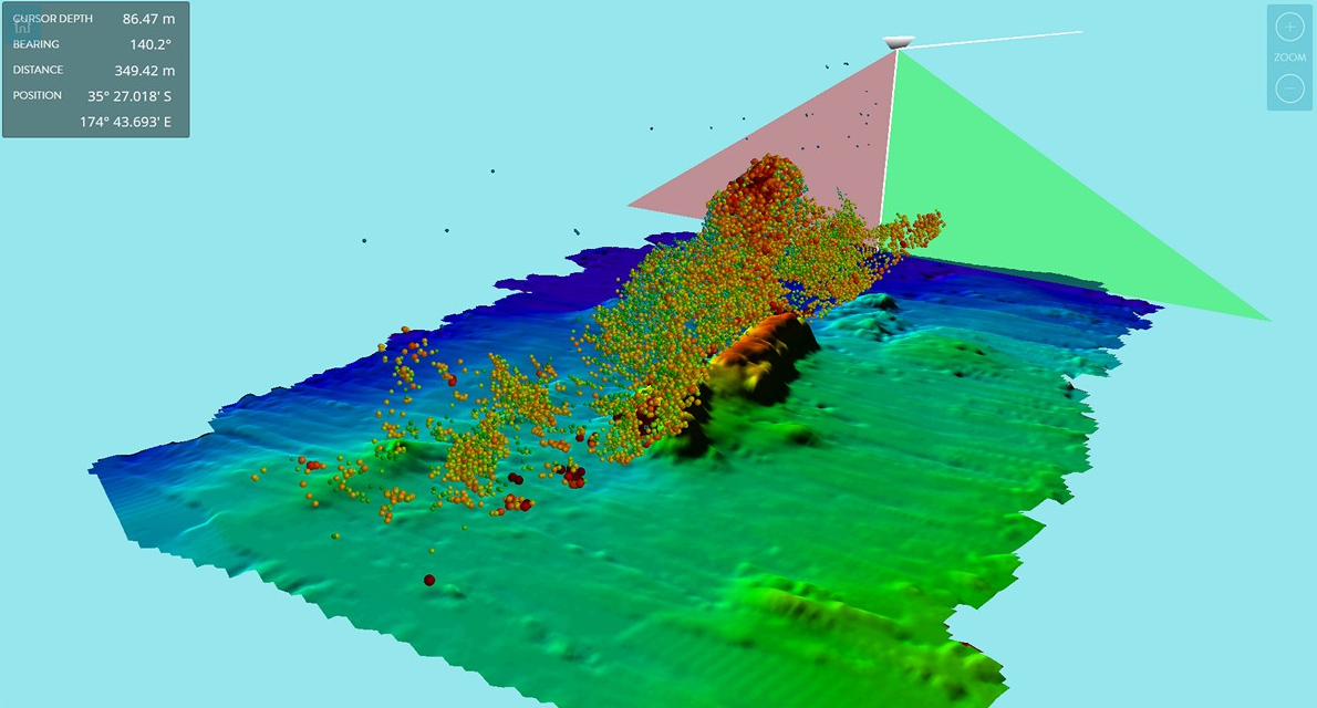
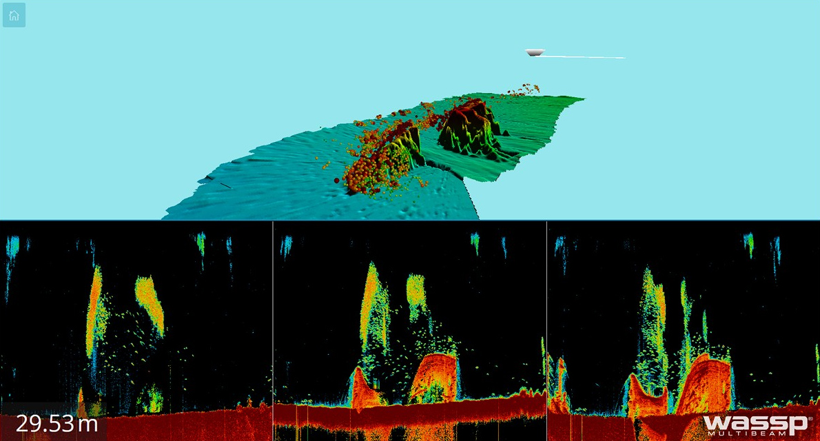
WASSP accurately profiles the water column and seafloor as a 3D visualization, highlighting reefs, wrecks, fish schools, seafloor hardness changes and foreign objects in the water column or on the seafloor. With real-time viewing and history recording, as well as integration with leading software platforms.
For further details, refer to WASSP Multibeam Echo Sounder – wasspmultibeam

Source: WASSP 3D sea floor mapping with fish stock integration

Meet the team on the water
Our cutting edge 8 metre aluminum plate boat is built for strength and stability on the water, equipped with state of the art WASSP multi-beam sonar technology, combined with high end Furno fish detection
TERRY TREMBLE
COMMERCIAL FISHERMAN AND MARINE OPERATOR


Send an Email
Business Card
MARINE SEAFLOOD MAPPING • WASSP MULTIBEAM SONAR • FISH STOCK MONITORING • WRECKAGE SEARCH
